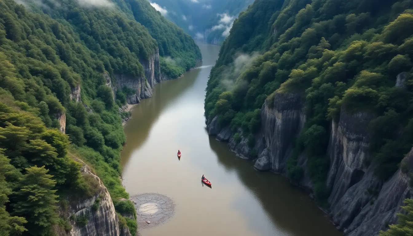
Social Sciences · World 3 of 8 · Years 7–8
Te Awa Tupua: Rivers, Floods and People
A river that is a legal person, a town built on its floodplain and a flood nobody forgot. Follow the water from mountain to sea.
Big question: What does a river need, what do the people beside it need, and how can we live with a river that sometimes floods?
- You'll make
- A river report for a real audience: a map of your river from source to mouth with grid references, a flood-risk map of one floodplain, the results of your rain-and-land tests, and three recommendations for living with the river, one of which speaks for the river itself.
- For
- Your regional council's river or flood team, a catchment or stream care group, civil defence, or iwi and hapū river guardians (by invitation), plus whānau at a class river expo
- Time
- 5 weeks · 2 sessions a week
Your mission
Why it matters
In June 2015 the Whanganui River rose higher than anyone living had seen, and water poured into homes along Anzac Parade. Two years later, Parliament recognised the same river as Te Awa Tupua, a living being with the rights of a legal person. Your local council, catchment group or civil defence team wants young people's ideas about living safely beside a river while respecting it. You will follow a river from source to sea, read its maps, test how land and rain make floods, and report back.
Most New Zealand towns grew up beside rivers, because rivers gave water, food, flat land and a road to the sea. The same flat land is where floods go. As storms get heavier, communities face hard choices about stopbanks, warnings, where to build and how to care for the whole catchment. Te Awa Tupua also asks a bigger question: what changes when we treat a river as an ancestor with its own wellbeing, not just as a drain or a resource?
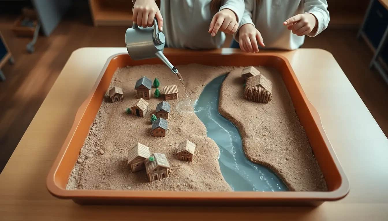
Your first step
Find the river or stream nearest your school on a map. Trace it with your finger upstream to where it begins and downstream to where it meets the sea or a bigger river. Write down three places it passes and one question you have about it.
Make it yours
Choose a context
Same big question, three different places to explore it. Pick the one that fits your class and community.
Te Awa Tupua, the Whanganui River
Follow Aotearoa's third-longest river 290 km from the slopes of Tongariro, through the gorges of Whanganui National Park, past river marae and Pipiriki, to the town and the Tasman Sea. Study the 2015 flood on Anzac Parade and the 2017 settlement that made the river a legal person.
Our town stream and its concrete
Pick a stream that runs through a town or city near you, perhaps hidden in pipes under roads. Measure how much of its catchment is roofs, roads and car parks, test how fast rain soaks into different surfaces, and find out what happens to the stream after a downpour. Ideal for urban schools.
Edgecumbe and the Rangitāiki stopbanks
A rural river town protected by stopbanks. In April 2017, during the remnants of Cyclone Debbie, a stopbank on the Rangitāiki River gave way and about 2,000 people were evacuated. Use it to judge what stopbanks can and cannot do, and how warnings reached people in time.
TRACE
Week by week
Two sessions a week, each with Getting started and Stretch support so the whole class works together.
- W1From the mountain to the sea: how a river worksTime & Place: Follow the water · Time & Place: Reading a topographic map
- W2Rivers and people: Te Awa Tupua and the floodplainRelationships: Ko au te awa, ko te awa ko au · Relationships: Why live on a floodplain?
- W3The 2015 flood: accounts and causesAccounts: When the river rose · Causes & Consequences: Rain, land and runoff
- W4Protection, warnings and our own catchmentCauses & Consequences: Stopbanks and warnings · Causes & Consequences: Fieldwork: our catchment
- W5Judge the options and speak for the riverEvaluate: Living with the river · Evaluate: River expo
Hands-on
Activities
Investigations and projects that fit the weeks above. Open one to see what you need and how you'll know it worked.
River profile from source to seaHow does a river change from the mountains to the mouth?Open
You need: a long strip of paper (about 2 m) · a map of your river (Topo50 extracts or an atlas) · coloured pencils
- Mark the source at one end and the mouth at the other.
- Draw the height of the land along the river using the contour lines (high and steep at the source, low and flat near the sea).
- Mark tributaries, towns, marae, bridges and dams at the right places.
- Label the upper, middle and lower course and describe the river in each: speed, width, what it carries.
- Shade the floodplain in the lower course.
How you'll know: Your profile shows the river getting lower, wider and slower downstream, with at least eight labelled features.
Go further: Add the Tongariro Power Scheme diversion near the source and explain how it changes the river.
Fits week 1 →Grid-reference treasure huntCan you find an exact place on a topographic map?Open
You need: Topo50 extracts of your river · a set of clue cards · a ruler
- Remember: eastings first (along the corridor), then northings (up the stairs).
- Find each four-figure grid reference and name the feature in that square.
- Now try six-figure references: split each square into tenths to find the exact point.
- Write three clues of your own for another group, including one bridge and one place on the floodplain.
How you'll know: You can give and find six-figure grid references correctly and say what the contour lines show about each place.
Go further: Use the scale bar to measure the distance along the river between two of your clues.
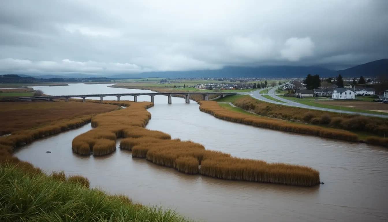
Fits week 1 →Sand river and floodplain modelHow does a river build a floodplain, and what happens to houses on it?Open
You need: a length of guttering or a long plastic tray · sand · a watering can or jug · a bucket to catch water · small blocks or model houses · a tarp
- Tilt the tray slightly and pack sand along it, with a hill at the top end.
- Pour water slowly at the top. Watch the channel form, bend and carry sand downstream.
- Look for where the sand is dropped: on the flat lower part and at the 'mouth'.
- Place model houses on the flat land beside the channel.
- Pour a much bigger 'flood' and record what happens to the houses.
How you'll know: You can explain erosion, transport and deposition, and show why floodplains are both good places to live and risky ones.
Safety: Work outside or on a tarp, mop spills straight away, and wash hands after handling wet sand.
Go further: Add a model forest (moss or sponge) on the hill and compare how fast the flood arrives.
Fits week 2 →Resource or ancestor?What changes when a river is treated as a living being?Open
You need: the Te Awa Tupua reading · a two-column chart · role cards: Te Pou Tupua, a farmer, a kayak guide, a power company, a council engineer, a river whānau
- List what people take from the river (water, gravel, power, food) and what the river needs (clean water, flow, room to move).
- Read how the 2017 law describes the river: one living whole from the mountains to the sea.
- In role, discuss a proposal to take more water from the upper river.
- Te Pou Tupua sums up what the river would ask.
- Write a reflection: whose voice was hardest to hear, and why?
How you'll know: You can describe what Te Awa Tupua means and use it to weigh a real decision from more than one point of view.
Go further: Find another river in the world that has been given rights and compare it with Te Awa Tupua.
Fits week 2 →Infiltration testWhy do towns flood faster than forests?Open
You need: tin cans with both ends removed · a measuring jug · water · a stopwatch · a ruler · a results table
- Choose three surfaces: lawn, bare or trampled soil, and gravel or bark.
- Push a can 3 cm into the ground on each surface.
- Pour 250 ml of water into the can and start the stopwatch.
- Stop when the water has soaked away (stop after 10 minutes if it has not).
- Pour 250 ml onto asphalt and measure how far it runs.
- Repeat each test three times and find the mean time.
How you'll know: Your results show a clear difference between surfaces, and you can link hard or compacted ground to faster runoff and flooding.
Safety: Test only inside the school grounds, away from traffic. Wear gloves or wash hands afterwards. Tins can have sharp edges; the teacher prepares them and covers the rims with tape.
Go further: Test the same lawn where people walk every day and where they don't. What does compaction do?
Fits week 3 →Flood hydrographHow does a river respond to rain?Open
You need: rainfall and river-level data for June 2015 (or a recent rain event) from your regional council's environmental data site · graph paper or a spreadsheet
- Plot rainfall per hour as bars along the bottom of the graph.
- Plot the river level as a line on the same time axis.
- Mark the peak rainfall and the peak river level.
- Measure the lag time between them.
- Explain why the river keeps rising after the rain stops.
How you'll know: Your graph shows the lag between rain and peak flow, and you can explain it using the size of the catchment.
Go further: Compare the hydrograph of a big forested catchment with a small urban stream.
Fits week 3 →Stopbank challengeWhat can a stopbank do, and what can't it do?Open
You need: your sand river model · modelling clay or wet clay soil · a measuring jug · a ruler
- Build clay stopbanks along both sides of the channel on the floodplain.
- Pour a normal flow. Does the water stay in the channel?
- Pour a big flood. Measure the water height against the stopbank.
- Pour an even bigger flood. Where does the water go? What happens downstream?
- Make a weak spot in one stopbank and test again.
How you'll know: You can explain that stopbanks lower the risk for most floods but can be overtopped or breached, and that they push water further downstream.
Safety: Work on a tarp and mop spills straight away.
Go further: Design an alternative that gives the river room: a spillway or a wetland area that can flood safely.
Fits week 4 →Catchment fieldwork surveyHow much of our catchment lets rain soak in?Open
You need: a clipboard and survey grid · a tape measure · a camera or tablet · a printed aerial photo of the school or stream · gumboots or old shoes
- Divide the aerial photo into a 10 × 10 grid.
- For each square, decide if it is mostly roof, road or paving (hard) or grass, garden or trees (soft).
- Check a few squares on the ground and photograph them.
- At the stream bank (with adults), estimate vegetation cover and record any debris.
- Calculate the percentage of hard surfaces.
How you'll know: You have a shaded map, a percentage and at least one photo as evidence.
Safety: Stay with your group and an adult. Do not enter the water. No stream fieldwork after heavy rain or if the water is high or fast. Wash hands afterwards.
Go further: Suggest where a rain garden or planting would slow the most water, with a grid reference.
Fits week 4 →Look closer
From the real world
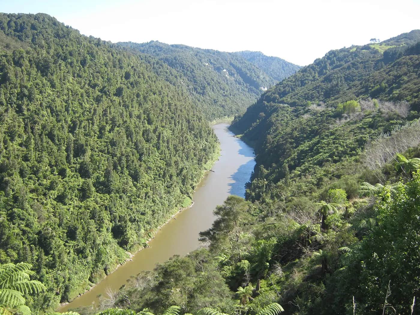
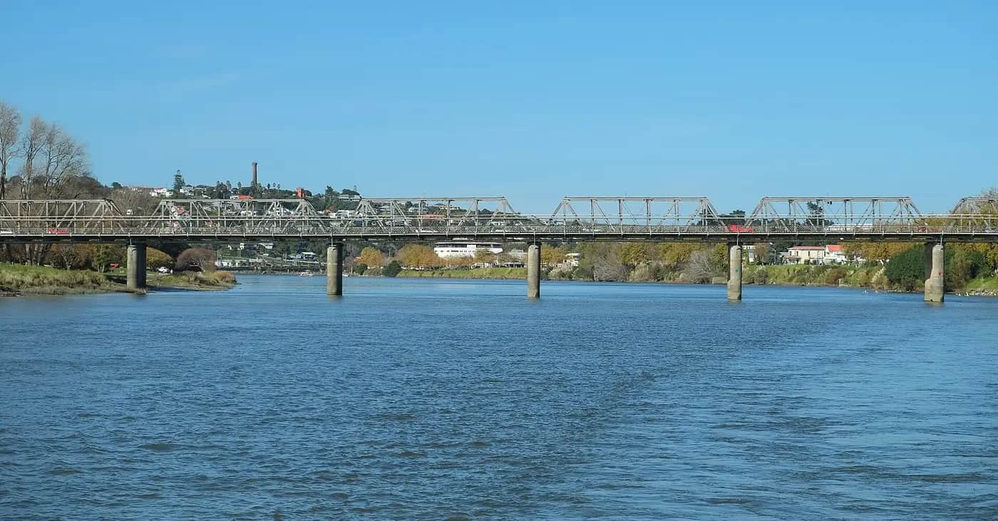
Background reading
Read to understand
Short readings written for Kōkiri Learn students, with their sources.
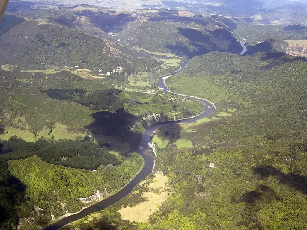
- From the mountain to the sea: how a river system worksEvery river is a whole system: a catchment, tributaries, bends, a floodplain and a mouth. Here is how it fits together.
- Ko au te awa, ko te awa ko au: Te Awa TupuaIn 2017 the Whanganui River became a legal person. Here is what that means, and why Whanganui iwi fought for it for so long.
- When the river rose: the 2015 Whanganui floodWhat made the Whanganui River flood in June 2015, what happened to the town, and how people protect floodplains.
Trusted NZ sites
Explore more
Placed at the stage of the journey where each one helps.
Time & Place
Rivers ↗Te Ara – The Encyclopedia of New Zealand
How New Zealand's rivers formed and how they behave from source to sea.
Time & Place
Water catchments ↗Science Learning Hub – Pokapū Akoranga Pūtaiao
What a catchment is, with clear diagrams.
Time & Place
New Zealand topographic maps ↗Toitū Te Whenua Land Information New Zealand
Free Topo50 maps to download and print for your river.
Time & Place
NZ Topo Map ↗topomap.co.nz
Zoom along any river on the official topographic maps and read grid references.
Relationships
Te Awa Tupua (Whanganui River Claims Settlement) Act 2017 ↗NZ Legislation
The law that recognises the river as a legal person, with the Tupua te Kawa values.
Relationships
Ngā Tāngata Tiaki o Whanganui ↗Ngā Tāngata Tiaki o Whanganui
The iwi river trust's own account of Te Awa Tupua.
Relationships
Whanganui Journey ↗Department of Conservation
The river trip through the national park, with maps and river marae.
Accounts
Rivers and Us ↗Science Learning Hub – Pokapū Akoranga Pūtaiao
How people and rivers affect each other, with NZ case studies.
Causes & Consequences
Floods ↗Te Ara – The Encyclopedia of New Zealand
Why New Zealand rivers flood, and big floods including Edgecumbe 2017.
Causes & Consequences
Natural Hazards and Flood Management ↗Horizons Regional Council
How the Manawatū–Whanganui council manages stopbanks, river gauges and warnings.
Causes & Consequences
LAWA: Land, Air, Water Aotearoa ↗LAWA
River flow and water data for rivers near you.
Evaluate
Floods ↗Get Ready – National Emergency Management Agency
What to do before, during and after a flood, to test your recommendations.
Evaluate
Wetlands ↗Science Learning Hub – Pokapū Akoranga Pūtaiao
How wetlands slow and store floodwater, as an option to weigh.
Real audiences
- Your regional council's river management or flood protection team
- A local catchment, stream care or Landcare group
- Civil defence or Fire and Emergency staff
- Iwi or hapū river guardians, by invitation and following their protocols
- Whānau at a class river expo
Work with other schools
- Pair with a school upstream or downstream on the same river and swap river profiles and survey results.
- Run the same infiltration test in two schools and compare the results in a shared spreadsheet.
- Hold a joint online river expo with a school on a different river, comparing floods and protection.
Stretch challenges
- Graph a rainfall and river-level hydrograph for the June 2015 Whanganui flood and explain the lag time.
- Compare Te Awa Tupua with another river given legal rights overseas, and judge which approach protects the river more.
- Design a rain garden for the school and calculate how much roof water it could slow down.
- Research how the regional council decides how high to build a stopbank, and what a '1% chance' flood means.
- Interview a river guide, farmer or kaumātua about how the river has changed in their lifetime (with permission).
New Zealand Curriculum
What this world covers
Mapped to the refreshed Phase 3 statements. The whole class covers both the Year 7 and Year 8 sequences over two years.
Social Sciences · Geography
River systems from source to mouth; the river as a living ancestor with mauri and the 2017 recognition of Te Awa Tupua; floodplain settlement; topographic maps and grid references
Year 8 sequence
Social Sciences · Geography
Rainfall and duration, deforestation and impermeable urban surfaces, stopbanks, forecasting and warnings, through the June 2015 Whanganui flood
Year 8 sequence
Social Sciences · Civics and society
What councils do: flood protection and river management paid for by rates, and councils' relationships with iwi through the Te Awa Tupua framework
Year 7 sequence
Mathematics and Statistics · Geometry
Map scales and grid references on 1:50,000 topographic maps
Year 8 sequence
Mathematics and Statistics · Statistics
Time-series graphs of rainfall and river level during a flood
Year 8 sequence
Science · Science practices
Fair tests: comparing how fast water soaks into grass, bare soil and asphalt
Year 7 sequence
For teachers: how to run it
This world teaches the flooding half of the Phase 3 Year 8 Geography content on natural hazards in the proposed Social Sciences statement of 12 August 2026: river systems from source to mouth; the river as a living ancestor with mauri and the 2017 recognition of Te Awa Tupua; floodplain settlement; topographic maps and grid references; rainfall and duration; deforestation, building on flood-prone land and impermeable urban surfaces; stopbanks, forecasting and warnings; and consequences for lives, property, marae, urupā and infrastructure. It follows the Whanganui Intermediate Cycle A Term 2 plan, including the fieldwork week on the awa (measuring vegetation cover, debris and impermeable surfaces), the shared base map and a Horizons Regional Council or Civil Defence visitor. The evidence of learning is a hazard report on the June 2015 Whanganui flood; pair this world with Shaky Isles for the earthquake content and the four Rs. Year 7 students in a combined class meet strong map skills and the idea of belonging to a place, which feeds the migration world Why We Move. Ideas from the PDC water module ('slow it, spread it, sink it'; a catchment is defined by flow, not ownership; compacted soil can absorb less than a tenth of the rain healthy soil can) are reworded here for 11–12-year-olds. Protocols: Te Awa Tupua is a taonga and an ancestor of Whanganui iwi. Use the words of the settlement and Ngā Tāngata Tiaki o Whanganui, invite iwi or hapū to share kōrero only through the school's own relationships, and do not ask students to write their own versions of the Tupua te Kawa values or pepeha for the river. For other rivers, ask mana whenua how they speak of their awa. Wellbeing: some whānau lost homes or taonga in 2015 or in other floods; tell whānau before you start, avoid dramatic footage as a hook, and never ask a child to retell their own experience. Safety: all river and stream fieldwork needs a risk plan, parent helpers, a site visit beforehand, no entering water above the knee, no fieldwork after heavy rain or when the river is high, gumboots or old shoes, hand-washing after touching water or soil, and cuts covered. The infiltration test needs only a tin can with both ends removed and a watering can; the stream-table model needs a tarp and buckets. Prep: printed Topo50 extracts of your river (free from LINZ or topomap.co.nz), your regional council's flood-hazard map, river-level and rainfall data from the council's environmental data site, a long strip of paper for the river profile, guttering or a long tray, sand, a watering can, tins, a stopwatch, clay and small blocks. Differentiation: a partly completed river-profile diagram, grid-reference cards with the square already shaded, and sentence frames for the report; stretch students with a hydrograph comparing rainfall and river level, a six-figure grid-reference treasure hunt, or a comparison of Te Awa Tupua with other rivers given rights overseas. Misconceptions to listen for: 'floods are rare accidents' (floodplains are made by floods), 'a stopbank makes the land safe' (it lowers the risk, and bigger floods can overtop or breach it), 'the river is only the water' (Te Awa Tupua includes the whole river from the mountains to the sea, its tributaries and its people), and '100-year flood means once a century' (it means about a 1% chance in any year). Kārearea asks one question during week 3; it never gives answers.
Plan this world into any term with the two-year planner. Students can record their thinking in their Kōkiri Learn portfolio.
More Social Sciences worlds
 4 weeksTō Mātou Rohe: Stories of Our Place
 5 weeksMana Motuhake: Power, Decisions and People
 5 weeksWhy We Move: Migration and Belonging
 5 weeksShaky Isles: Hazards and Getting Ready
 5 weeksSilk Roads and Sea Routes: When Worlds Trade
 5 weeksStanding Up: Civil Rights and Youth Voice
 5 weeksOur Money, Our Community
Ready to run it with your class?
Free trial for NZ schools. One combined Years 7–8 class, any term.